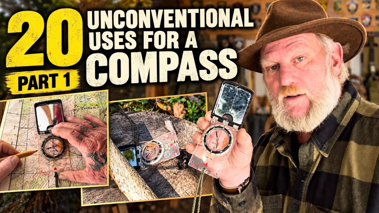
How to use a compass for 20 unconventional bushcraft skills
Predicament Measures is reader-supported: some links on this page are affiliate links, and as an Amazon Associate Predicament Measures earns from qualifying purchases at no extra cost to you. Learn more.
A 1:10,000 scale map provides a 10 cm by 10 cm grid square that allows for precise 8-digit MGRS coordinate plotting using a base plate compass. While most people view a compass as a passive needle for finding north, it functions as a high-utility multi-tool for optics, geometry, and inspection. This method suits weight-conscious hikers and bushcraft students who need to maximize tool utility, while those seeking military-grade lensatic training should look elsewhere.
When to use this approach, and when not to
Readers who should use this method
- Weight-conscious hikers should use this method to replace multiple tools like a protractor, ruler, and magnifying glass with a single multi-functional compass.
- Bushcraft students should use this method to master advanced navigation skills like 15-second map reading and MGRS plotting.
- Preppers building emergency kits should use this method to learn how to use a compass for hygiene and signaling in a survival situation.
- Overlanders should use this method to identify precise locations on detailed grid maps using a base plate as a measurement tool.
Readers who should skip this method
- People seeking military-grade lensatic training should skip this method and refer to military land navigation manuals.
- Users with non-graduated compasses should skip this method and purchase a base plate compass with clinometer and centimeter markings.
What to do next about the compass
- Verify the clinometer by checking for a movable clinometer arrow to ensure slope and incline measurement.
- Check for centimeter markings on the base plate to verify the 4.5 cm distance required for 15-second map readings.
- Prepare charred material by pre-charring wood to create a coal for use with the magnifying lens.
Essential Features for a Multi-Purpose Compass
A versatile compass must possess specific hardware to perform more than basic navigation. To unlock the full utility of the device, the base plate must feature centimeter and inch markings, a movable bezel ring, a built-in mirror, a magnifying lens, and adjustable declination. You must also ensure the device has orienteering lines and a clinometer—an arrow that moves independently when tilted to measure slope, grade, and incline. Without these specific features, the compass cannot function as a ruler, protractor, or signaling device.
What is a clinometer?
A clinometer is a measurement tool on a compass that moves independently when the device is tilted. It allows a user to determine the slope, grade, and incline of the terrain. This feature is essential for measuring the steepness of a hill or the grade of a trail.
Utilizing the Mirror for Signaling, Hygiene, and Inspection
The integrated mirror provides five distinct uses that go beyond simple orientation. It serves as an inspection tool to see around urban corners or check the undercarriage of a vehicle for mechanical issues. In a survival situation, you can use the mirror to flash signals or Morse code using the built-in aiming hole. For first aid, the mirror allows you to inspect skin for ticks, splinters, or insect bites that are hidden from view. Finally, it serves as a hygiene tool for brushing teeth or trimming a beard, removing the need to carry a separate camp mirror.
The Base Plate as a Measurement and Mapping Tool
The base plate serves as a physical bridge that connects the two-dimensional lines of a map to the three-dimensional reality of the terrain. Because it is a straight edge, you can use it as a ruler to measure wood or string, or as a tool to draw route plan sketches. It also functions as a protractor for MGRS plotting, allowing you to determine precise locations without extra gear. Think of the base plate as a ruler.
What is MGRS?
MGRS is the Military Grid Reference System, a standard used for plotting precise grid coordinates on a map. It uses a grid-based system to identify a specific location using a series of numbers. This system is favored by land navigation students for its high degree of accuracy.
A base plate compass allows for high precision in locating 15-second map coordinates
Using a base plate compass for 15-second map reading allows for extremely high precision in locating coordinates. On a 15-second map, 1 minute of latitude or longitude is divided into 15-second increments, where every 3 millimeters equals 1 second. You can determine your position by measuring the distance from the grid line; for example, a measurement of 4.5 cm equals 15 seconds. For longitude, you must measure at an angle to account for the way lines compress toward the North Pole. To calculate an 8-digit MGRS coordinate, you must identify the grid square and measure the easting and northing in centimeters. For a 1:10,000 map, each centimeter equals 100 meters.
How the base plate compass differs from a lensatic compass and mils
- Base plate compass
- Features a flat plate for measuring and sketching.
- Lensatic compass
- A military-style compass without a flat base plate for measuring.
- Mils
- A military unit of measurement for degrees.
- Degrees
- The standard unit required for the navigation methods in this series.
The magnifying lens on the compass serves as a backup for reading glasses
The magnifying lens on the compass serves as a backup for reading glasses or for inspecting small debris like burrs or stingers in the skin. It also functions as a third ignition source for fire starting. Because the lens is not very powerful or large, you must use it in direct sunlight on charred material. Once the lens creates a coal, you can transfer it to a bird’s nest to start a fire. It provides a reliable backup for when a lighter or ferro rod is unavailable.
When NOT to use this method
Do not use this method if your compass lacks a clinometer or centimeter markings, as these specialized features are required for these specific skills. Instead, purchase a versatile base plate compass like the Suunto MC-2. For navigation tasks that do not require base plate measurements, a lensatic compass remains the standard military option.
How to Plot an 8-Digit MGRS Coordinate
- Identify the grid square (e.g., 71 and 23) on the 1:10,000 map.
- Place the zero line of the compass on the eastern grid line.
- Measure the easting (e.g., 1.7 cm for 170 m) on the centimeter scale.
- Place the zero line on the northern grid line.
- Measure the northing (e.g., 2.2 cm for 220 m) on the centimeter scale.
- Combine the readings to find the 8-digit coordinate (e.g., 7117 2322).
A hiker uses a base plate compass to determine an 8-digit MGRS coordinate
Suppose a hiker named Sarah is using a 1:10,000 map to find her position in a forest. She identifies her grid square as 71 and 23. Sarah places the zero line of her base plate compass on the eastern grid line and measures 1.7 cm for the easting, then rotates the compass to the northern grid line and measures 2.2 cm for the northing. She successfully determines her 8-digit MGRS coordinate is 7117 2322. If Sarah used a lensatic compass instead, she would struggle to get an accurate 1.7 cm measurement because she would lack the straight edge provided by the base plate.
Compass leaves these details unconfirmed
By consolidating several tools into one piece of bushcraft gear, you reduce the weight of your pack while increasing your survival versatility. This approach transforms a standard navigation tool into a multi-functional survival kit. You gain precision, and you save space.
Frequently Asked Questions
Can I use any compass for these tasks?
The compass must be in degrees (not mils or quadrants) and include a mirror, clinometer, and centimeter markings to perform all 20 unconventional uses. If your compass lacks these specific features, it will not be suitable for the precise measurements or optical tasks described.
How do I use the lens to start a fire?
The magnifying lens starts a fire by concentrating sunlight onto pre-charred material to create a coal. You must ensure you have good sunlight and prepared material, as the lens is not large enough to ignite raw wood directly.
What is the purpose of the clinometer?
The clinometer measures slope, grade, and incline by using an arrow that moves independently when the compass is tilted. It allows you to determine the steepness of the terrain you are navigating.
How do I calculate longitude on a 15-second map?
To calculate longitude on a 15-second map, you must measure at an angle because the grid lines compress toward the North Pole. Place the zero line on one side and move the compass until the 45 mark touches the grid line to determine the correct offset.
Reported from 20 Unconventional Uses for a Compass | Skills Part 1, published by David Canterbury.
Related posts:
 Florida bushcraft packing: Everglades swamp survival gear
 Paladin33 P33 Bail Pouch review: A covert, pivoting travel solution
 Hidden Trailer Stealth Camper Performance and Design
 Mudslide Survival and Pre-Construction Planning
 Maxpedition Fliegerduffel review: A versatile hybrid for dispersed camping
 OdenWolf Woods Knife Review: A Dedicated Bushcraft Tool
 FLISSA EDC Fixed Blade Knife review: a compact carving tool
 Camping Gear and Gadgets: Essentials for Comfort and Preparedness